Velodyne LIDAR
Velodyne Lidar module supports Lidars from Velodyne. It supports three lidar sensors:
Check:
- Possible System configuraitons
- How to connect the Device and Software Setup
- Velodyne LIDAR’s possible Synchronization
- Available Output sections
- Vizualization of Velodyne LIDAR’s data
Key applications
- Autonomous vehicles with real-time perception data that enables safe and reliable operation of autonomous driving and advanced vehicle safety. Achieved range, accuracy and resolution are capable of autonomy level 4 and level 5.
- High-level ADAS for safe navigation, collision avoidance, lane keeping assist, automatic emergency braking, …
- Trucking
- Mapping for building highly accurate 3D models of any environment.
- Smart city for monitoring and measuring conditions areas for pedestrian safety, vehicle traffic, parking space management, …
System canfigurations
Standalone system
Velodyne LIDAR can be used as a standalone system that obtains software synchronization. That means only Velodyne LIDAR sensor is used for the measurement.

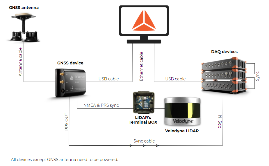
Typical system
Velodyne LIDAR sensors is usually used together in system with other devices, such as:
- Dewesoft DAQ devices
- GNSS devices
Such configurations allow the user to perfom measurements on higher level of complexity, but at the same time keeping it simple and completely synchronized inside DewesoftX software. The possibility to gather data from multiple sources gives the user better overview and detailed information about measured systems.
