Velodyne outputs can be enabled with a click on Used button, besides each channel.
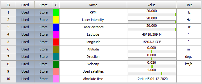
Velodyne LIDAR module outputs the following channels:
| Output channel name | Description |
|---|---|
| RPM | Is the set frequency of LIDAR sensor rotation measured in Hz by default. |
| Laser intensity | Represents the enery of the reflected laser pulse. Coloring of the points is related to the intensity. |
| Laser distance | Represents the distance or depth of the laser pulse, which practically means the distance of the surrouning objects from the LIDAR sensor. |
| Latitude | Represents the latitude data obtained from the GNSS device. |
| Longitude | Represents the longitude data obtained from the GNSS device. |
| Altitude | Represents the altitude data obtained from the GNSS device. |
| Direction | Represents the direction data obtained from the GNSS device. |
| Velocity | Represents the velocity data obtained from the GNSS device. |
| Used satellites | Represents the used satellites data obtained from the GNSS device. |
| Absolute time | Represents the absolute time obtained from the GNSS device. |